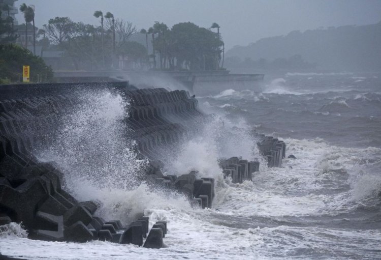
Typhoon Shanshan Hits Japan's Kagoshima Prefecture

Typhoon Shanshan has made landfall in Japan's southwestern prefecture of Kagoshima.
Japan's Meteorological Agency says the storm made landfall near Satsumasendai City.
The agency has issued emergency warnings for strong winds and high waves in Kagoshima Prefecture, excluding the Amami region, and a storm surge emergency warning for the prefecture's Satsuma region.
Winds are picking up across Kyushu. Gale-force winds of more than 183 kilometers per hour were observed at Makurazaki City in Kagoshima Prefecture.
Kagoshima City had maximum gusts of nearly 140 kilometers per hour.
Areas across Kyushu, as well as in western and central Japan, are getting heavy rain due to an inflow of warm, moist air.
Bands of heavy rain clouds were generated over northern Miyazaki Prefecture, over Kagoshima's Satsuma region and over central and northern Oita Prefecture.
The Meteorological Agency is warning of prolonged downpours in these locations.
People should be on high alert for mudslides, flooding in low-lying areas and swelling rivers.
Western Japan should brace for strong winds.
Maximum wind speeds of 162 kilometers per hour are forecast for Southern Kyushu, 144 kilometers in northern Kyushu, 90 kilometers in Shikoku, 72 kilometers in the Amami region and 65 kilometers in the Chugoku region.
Maximum gusts of 234 kilometers are forecast for southern Kyushu, 198 kilometers in northern Kyushu, 126 kilometers in Shikoku and 108 kilometers in the Chugoku and Amami regions.
The Meteorological Agency says heavy rain emergency warnings could be issued for Kagoshima and Miyazaki prefectures.
Areas in eastern and western Japan that are far from the typhoon are also likely to get downpours.
Total rainfall in the 24-hour period, could reach 600 millimeters in southern Kyushu, 400 millimeters in northern Kyushu and Shikoku, 300 millimeters in the Tokai region, 200 millimeters in Kinki and Kanto-Koshin and 120 millimeters in the Chugoku region and the Izu Islands.


