AI accelerates Antarctic seafloor research
System analyses images in seconds to aid conservation efforts
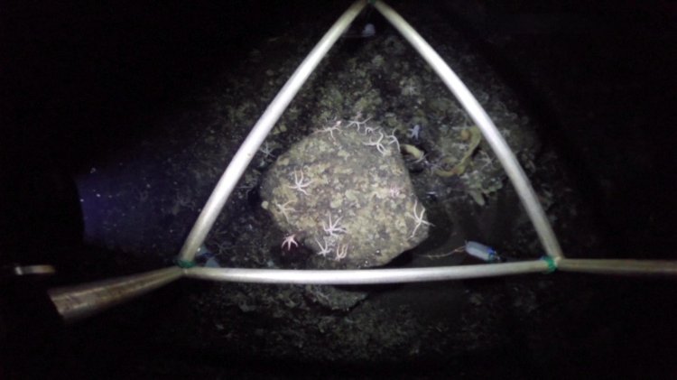
Scientists are deploying an AI system to rapidly analyse high‑resolution seafloor images from Antarctica, dramatically accelerating biodiversity surveys and enabling near real‑time results aboard research vessels. Developed by Germany’s Alfred‑Wegener‑Institut (AWI) OFOS team in collaboration with the British Antarctic Survey, the model was trained on a small set of carefully annotated photos from deep Weddell Sea dives and now identifies and labels organisms such as starfish, corals, sponges and fish in seconds — a task that previously could take hours per image because single frames can contain thousands of tiny animals.
The tool has begun processing a backlog of roughly 30,000 images and is being used to map vulnerable marine ecosystems on the Antarctic seabed, which hosts an estimated 94% of Southern Ocean species, many of them endemic. By clearing rubble through automated detection and supporting forensic‑style counts of species abundance and distribution, the AI can inform non‑invasive conservation measures and help determine protected areas without resorting to destructive sampling. Teams from AWI and the British Antarctic Survey report the system handles difficult cases such as overlapping organisms and flags novel or poorly represented species for human experts to review and teach the model.
Researchers say the speed gains are transformative: data collected on expeditions can now be analysed before ships return to port, allowing immediate scientific decisions and faster responses to signs of ecosystem change. Scientists warn that warming oceans, melting ice and increased human activity threaten Antarctic benthic communities, and that timely detection of shifting species ratios or local disappearances is critical. While the AI multiplies researchers’ capacity rather than replacing taxonomic expertise, it reduces the labor bottleneck that once kept years of imagery unprocessed.
Next steps include expanding training datasets, integrating 3D mapping and automating species classification further to create continuous digital records of deep‑sea life on future Polarstern and OFOS missions. Investigators emphasize that the technology will aid urgent conservation planning by revealing biological hotspots and documenting impacts of climate change on one of Earth’s most fragile and least explored ecosystems.