Oil spill seen near Iran export hub
Satellite images show slick near Kharg Island
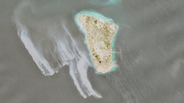
Satellite imagery shows a likely oil spill covering about 45 square kilometres west of Kharg Island, Iran’s main crude export hub. Copernicus Sentinel-1, -2 and -3 images from early May display a grey-white slick visually consistent with oil; analysts said newer images did not show evidence of continuing active leaks and the origin remains unknown.
Kharg Island handles roughly 90% of Iran’s oil exports, making the site strategically critical; experts warned a spill of this size could threaten marine ecosystems, fisheries and coastal infrastructure and exacerbate disruption to regional energy flows. The area has seen heightened military activity amid clashes and a U.S. naval blockade linked to the wider U.S.-Israel–Iran conflict, and analysts say conflict-related damage, tanker incidents or infrastructure failure could explain the slick though no official cause has been confirmed.
No immediate comment was available from U.S. military or Iranian U.N. representatives. Observers noted the incident may be among the largest regional spills since the escalation of hostilities and is likely to increase scrutiny of environmental and navigational risks in the Strait of Hormuz and adjacent waters.